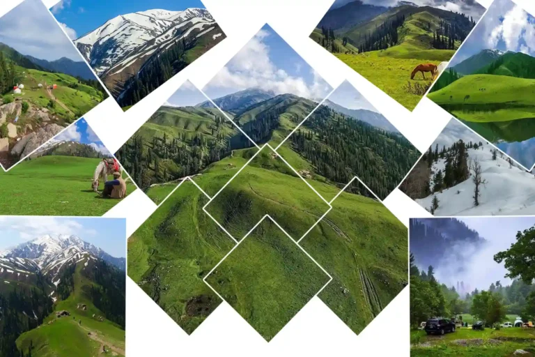
The road to Shogran leaves the main Kaghan Valley route at Kiwai and begins climbing through pine forest. The Kunhar River disappears below, the bends tighten, and the landscape changes from a busy valley road into a quieter mountain plateau.
Shogran sits at about 2,362 metres (7,747 feet) above sea level in Mansehra District, Khyber Pakhtunkhwa. The official Kaghan Valley travel guide places it about 34 kilometres from Balakot and describes the plateau as being surrounded by thick pine forest.
For travelers, Shogran works well as a short mountain base. You can walk around the forested plateau, stay overnight among the pines, continue deeper into Naran and Kaghan Valley, or make the higher excursion to Siri Paye Meadows.
This guide covers Shogran itself: where it is, how to reach it, road distances, weather, things to do, accommodation and practical trip planning.
Shogran Valley at a Glance
| Feature | Details |
|---|---|
| Location | Kaghan Valley, Mansehra District, Khyber Pakhtunkhwa |
| Elevation | Approx. 2,362 m / 7,747 ft |
| Distance from Balakot | Approx. 34 km |
| Access point | Kiwai on the Kaghan Valley road |
| Landscape | Pine forest and mountain plateau |
| Main excursion | Siri Paye |
| General travel season | Late spring through autumn, depending on road and weather conditions |
Source: Pakistan Tourism — Kaghan Valley Travel Guide
Where Is Shogran Located?
Shogran is located on a forested plateau above the main Kaghan Valley road in Mansehra District, Khyber Pakhtunkhwa.
It is not directly on the main road to Naran. From Balakot, travelers follow the Kaghan road toward Kiwai. A side road then climbs through forest toward Shogran.
The official tourism guide places Shogran about 34 km from Balakot and at approximately 2,362 metres above sea level.
Its location also makes Shogran practical for a short northern journey from Islamabad without having to travel as far up the valley as Naran.
Shogran Height Above Sea Level
Shogran stands at approximately 2,362 metres, or 7,747 feet, above sea level.
That elevation is high enough to create a noticeably cooler mountain environment than the lower valley around Balakot and Kiwai, while remaining considerably lower than Siri Paye and the surrounding peaks.
The height also explains much of Shogran’s landscape: conifer forest remains dominant around the settlement, while the higher excursion toward Siri Paye eventually reaches more open mountain grassland.
Shogran Distance from Major Cities
Road distances vary slightly according to the starting point, motorway exit and route used. The figures below are best treated as practical planning estimates rather than exact measurements.
| Starting Point | Approximate Road Distance | Typical Planning Time |
|---|---|---|
| Islamabad | 220–250 km | Approx. 5–7 hours |
| Lahore | 550–600 km | Approx. 9–10+ hours |
| Balakot | Approx. 34 km | Depends heavily on mountain traffic |
| Mansehra | Approx. 55–65 km | Approx. 2–3 hours |
| Abbottabad | Approx. 75–90 km | Approx. 3 hours |
| Naran | Approx. 60 km | Approx. 2–3 hours depending on traffic |
| Murree | Approx. 180–200 km | Route-dependent |
Islamabad to Shogran Distance
Islamabad to Shogran is roughly 220–250 km by road, depending on the starting point and route used.
A typical journey follows the Hazara Motorway toward Mansehra before continuing through Balakot and Kiwai.
Allow roughly 5–7 hours in normal conditions. Summer traffic, rain, roadwork and the final mountain climb can increase the journey time.
Lahore to Shogran Distance
Lahore to Shogran is roughly 550–600 km, depending on the route.
The usual journey follows the motorway toward the Islamabad region and then continues toward Mansehra, Balakot and Kiwai.
It is better treated as a full travel day. Allow around 9–10 hours or more once stops, traffic and mountain-road conditions are included.
Balakot to Shogran Distance
Shogran is approximately 34 km from Balakot.
The route first follows the Kaghan Valley road toward Kiwai. From Kiwai, a side road begins the final climb to the plateau.
Shogran to Naran Distance
Shogran to Naran is approximately 60 km by road.
The journey first descends from Shogran to Kiwai and then turns north along the main Kaghan Valley road.
For Naran, Kaghan, the upper valley and Saif-ul-Malook Lake, continue with the Naran–Kaghan Valley guide.
How to Reach Shogran
Most road approaches eventually converge on Balakot and Kiwai.
Islamabad → Mansehra → Balakot → Kiwai → Shogran
From Balakot, follow the Kaghan Valley road north toward Kiwai. At Kiwai, leave the main road and begin the climb toward Shogran.
Kiwai to Shogran Road
The final road from Kiwai climbs steeply through forest.
The official Kaghan guide describes this approach as approximately 7 km and states that normal cars and vans can use it under suitable conditions.
That does not mean every vehicle can safely make the climb every day.
After heavy rain, landslides, surface damage, ice or snow, road conditions may change significantly. During poor conditions, a local jeep or suitable 4×4 can be the safer option.
Drivers unfamiliar with steep mountain roads should check conditions locally before starting the climb.
Can a Normal Car Reach Shogran?
Yes, in normal dry-road conditions a standard car can reach Shogran via Kiwai.
The important qualifier is road condition. Heavy rain, snow, ice or road damage can change access quickly.
The road from Shogran to Siri Paye should be treated separately. That upper route is much rougher and local four-wheel-drive jeeps are commonly used.
What Is Shogran Famous For?
Shogran is known less for one individual landmark than for the character of the plateau itself.
Pine forest surrounds the settlement, grassy clearings appear between the trees, and the elevation creates a cooler summer environment than the lower valley floor.
Shogran is also the main base for the journey to Siri Paye, which gives travelers an easy contrast between forested mountain slopes and the more exposed meadow landscape higher above.
On clear days, several important Kaghan peaks appear around the horizon. Pakistan Tourism lists Musa Ka Musalla at 4,419 m, Makra at 3,885 m and Malika Parbat at approximately 5,290 m.
Shogran Forest and Landscape

Shogran is a forest destination before it becomes a high-mountain destination.
Pine and deodar cover the slopes around the settlement and make the final road from Kiwai part of the experience rather than simply an approach road.
Morning can bring mist between the trees, while open areas around the plateau provide wider views toward the surrounding mountains.
This mixture of enclosed forest and open mountain viewpoints is one of the main differences between Shogran and the busier valley environment around Naran.
Siri Paye from Shogran
Siri Paye is the main high-meadow excursion above Shogran.
The official Kaghan tourism guide describes the route toward Paya as a rugged road of roughly 8 km, climbing about 2,300 feet through pine forest before reaching the upper meadow landscape.
Siri, a small lake, lies along the route before the more open Paye meadow.
Most visitors use a local four-wheel-drive jeep for the upper mountain track. Road conditions can change with rainfall, mud, landslides, ice and snow.
For detailed information about the meadow itself, its height, Siri Lake, Makra Peak, seasonal conditions and upper-road access, read the full Siri Paye Meadows guide.
Shogran to Siri Paye Distance
For trip planning, use approximately 8 km from Shogran to Siri Paye by the upper mountain route.
Travel time is less predictable than distance because the track is steep and rough. Rain, mud, traffic and road damage can all slow the journey.
Jeep or Hike to Siri Paye?
Most visitors use a local jeep for the climb.
Travelers who want a longer active route may consider walking sections of the mountain approach, but this should not be treated as a casual plateau walk. The elevation gain and changing weather make preparation important.
For broader trail planning, see our guide to hiking in Pakistan.
Things to Do in Shogran

Walk Around the Plateau
One of the simplest ways to experience Shogran is on foot. The central plateau and surrounding forest allow short walks without committing to a demanding trek.
Explore the Pine Forest
The forest is one of Shogran’s strongest landscape features. Morning and evening walks are useful for seeing how quickly light, cloud and mist can change the atmosphere.
Enjoy the Mountain Views
Open sections of the plateau provide views toward the surrounding Kaghan mountains when cloud cover is limited.
Visit Siri Paye
Siri Paye is the classic excursion from Shogran and gives the trip a completely different landscape from the forested plateau below.
Photography
Forest mist, mountain ridges, cloud layers and the changing seasonal character of the plateau provide more photographic variety than a single fixed viewpoint.
Continue Through Kaghan Valley
Shogran works naturally as part of a longer journey through Kaghan Valley, particularly for travelers continuing toward Naran and the upper valley.
Shogran Weather
Shogran weather changes considerably by season and can also shift within a single day.
Its elevation keeps summer conditions cooler than the plains, while autumn brings colder nights and winter can bring significant snowfall.
Mountain rain can also affect road conditions, especially on the final approach from Kiwai.
For trip planning, treat weather and road access as connected. A forecast showing heavy rain or snow matters not only for what clothing to carry but also for whether the mountain roads remain comfortable and safe.
Best Time to Visit Shogran

| Season | What to Expect |
|---|---|
| Late Spring | Greener forest and improving access, although higher Siri Paye routes may still be affected by snow or wet ground. |
| Summer | Main visitor season, active hotels, green landscape and generally easier road access. Heavy rain can still affect mountain roads. |
| Early Autumn | Cooler conditions, fewer visitors and potentially clearer mountain views. |
| Winter | Snow, ice and less predictable access. Road conditions should be confirmed before traveling. |
Summer in Shogran
Summer is the conventional travel season for Shogran.
The plateau is green, accommodation is active and the route is generally more straightforward than during winter.
July and August can still bring heavy rain, so road conditions should not be ignored simply because it is summer.
Autumn in Shogran
Autumn brings cooler air and quieter conditions around the plateau.
It can be a good period for travelers who prefer fewer visitors, but colder nights become increasingly important as the season advances.
Winter in Shogran
Snow transforms the plateau but also changes the practical nature of the trip.
Roads can become icy or temporarily blocked, and vehicle restrictions may be introduced during severe conditions.
If Siri Paye is part of the plan, check that road separately. Shogran may be accessible while the upper Siri Paye route remains blocked.
Local authorities have previously restricted unsuitable vehicles during difficult snow conditions. For an example of winter road restrictions, see Dawn’s reporting on access controls in the area.
Where to Stay in Shogran
Shogran has a mix of guesthouses, hotels and larger resorts around the plateau.
Instead of choosing only by room price, check practical details such as:
- Road access to the property
- Heating outside summer
- Hot water
- Backup electricity
- Parking
- Room-sharing arrangement
- Whether the hotel can arrange a Siri Paye jeep
During summer weekends and public holidays, booking ahead is sensible.
Shogran or Naran?
Shogran and Naran belong to the same broader Kaghan journey, but they offer different experiences.
| Shogran | Naran |
|---|---|
| Forested plateau | Main upper-valley tourism town |
| Quieter setting | Busier commercial base |
| Main excursion: Siri Paye | Main excursions include Saif-ul-Malook and upper Kaghan |
| Strong forest and meadow combination | Better base for exploring farther north |
| Works well for a short mountain stay | Works well for a longer upper-valley itinerary |
If time allows, the two destinations work better together than as substitutes.
Shogran and the Wider Kaghan Valley
Shogran is only one part of the wider Kaghan landscape.
- Kiwai: The turn-off point below Shogran and an important stop on the main valley road.
- Balakot: The major gateway town before entering the Kaghan Valley.
- Kaghan: A smaller valley settlement farther north.
- Naran: The main upper-valley tourism base.
- Saif-ul-Malook Lake: The well-known alpine lake above Naran.
- Siri Paye: The high meadow excursion directly above Shogran.
For the full regional route, see the Naran–Kaghan Valley guide.
Is Shogran Suitable for Families?
Shogran itself can work well for families because hotels, short walks and the main plateau are concentrated in a relatively small area.
The Siri Paye excursion requires more consideration because it uses a rough mountain track.
Families traveling with very young children, elderly relatives or anyone with mobility or health concerns should ask about the current road before traveling upward.
Practical Travel Tips for Shogran
- Check current weather and road conditions before departure.
- Carry a warm layer even during summer.
- Keep rain protection during unstable weather.
- Wear shoes suitable for wet or uneven ground.
- Carry enough cash for small local expenses.
- Download maps before entering areas with unreliable mobile data.
- Start mountain-road journeys early enough to avoid unnecessary night driving.
- Check the Siri Paye road separately from the Kiwai–Shogran road.
- Use experienced local drivers when upper-road conditions are difficult.
Frequently Asked Questions About Shogran
Where is Shogran located?
Shogran is located on a forested plateau above Kiwai in Kaghan Valley, Mansehra District, Khyber Pakhtunkhwa.
What is the height of Shogran?
Shogran is approximately 2,362 metres, or 7,747 feet, above sea level.
How far is Shogran from Islamabad?
Practical road estimates are generally around 220–250 km depending on the starting point and route used.
How far is Shogran from Lahore?
The journey is roughly 550–600 km depending on the motorway route and starting point.
Can a normal car reach Shogran?
Yes, in suitable dry-road conditions. The official tourism guide describes the Kiwai–Shogran road as usable by normal cars and vans. Rain, snow, ice or road damage can change the situation, so current conditions should be checked first.
How far is Siri Paye from Shogran?
The official Kaghan tourism guide describes the mountain route toward Paya as roughly 8 km from Shogran.
What is the best time to visit Shogran?
Late spring through autumn generally provides the easiest conventional road access. Heavy rain, early snowfall or winter snow can still affect travel.
How far is Shogran from Naran?
The road journey is approximately 60 km. Travelers first descend toward Kiwai and then continue north along the Kaghan Valley road.
Is Shogran suitable for families?
Yes, especially around the main plateau and hotel area. The Siri Paye excursion uses a much rougher mountain track and should be considered separately.
Final Thoughts
Shogran works because the landscape changes without requiring a long journey into the high mountains.
The plateau gives you pine forest, open mountain views, accommodation and short walks in one compact area. Above it, Siri Paye adds a different environment for travelers who want to go higher.
Rather than treating Shogran as only a stop before Naran, give the plateau enough time to show its own character.
If you prefer transport, accommodation and the Siri Paye jeep excursion arranged together, see the Shogran & Siri Paye Tour.
