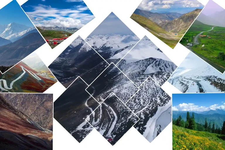
There is no forest to leave behind at Babusar. The treeline gave out somewhere below Jalkhad, and by the time the N-15 climbs the last switchbacks to the pass at 4,173 metres, there has been nothing but grass, rock, and sky for the better part of an hour. The meadows do not open up after a trek. They are simply there, on both sides of the highway, from Jalkhad to the top and down the far side toward Chilas.
This is the highest point in the whole Kaghan Valley, and unlike almost every other alpine meadow in Pakistan, you can reach it in a car. That fact defines the place. It is why families stop here in July and stand in the wind for ten minutes and drive on. It is also why almost nobody sees what is actually here.
What the Roadside Hides
The grasslands on these slopes are where Gujjars and other nomads migrate each summer to graze sheep, goats, and cattle. Their camps sit back from the road, on ground the tour jeeps never stop at. Meltwater streams cross the grass. Wildflowers come up in July across slopes that most visitors photograph from a car window at 60 kilometres an hour.
On the Chilas side, below the pass, Gitidas Meadows spread out in rolling green plains studded with wildflowers and ringed by peaks, often compared to the Deosai Plains but far more secluded. Nanga Parbat reads to the northeast from the pass on a clear day. The stone minaret at the top marks the highest point. Everything else at Babusar asks you to get out of the vehicle and walk a few hundred metres from it.
Babusar Top Meadows at a Glance
| Feature | Detail |
| Location | Boundary of Khyber Pakhtunkhwa and Gilgit-Baltistan |
| Elevation | 4,173 m (13,691 ft); highest point in the Kaghan Valley |
| Highway | N-15 National Highway, Naran to Chilas |
| Distance from Naran | Approx. 66 to 80 km; 2 to 3 hrs by car |
| Distance from Chilas | Approx. 40 km; 1.5 hrs |
| Access | Paved road to the pass; no trek required |
| Vehicle | Car possible; 4×4 or high-powered vehicle recommended |
| Season | Late May or June to late October, snow dependent |
| Peak Bloom | July |
| Nearest Town South | Jalkhad (3,140 m); 27 km from the pass |
| Nearby Meadow | Gitidas Meadows, on the Chilas side below the pass |
| Visible Peak | Nanga Parbat to the northeast on clear days |
| Herding Communities | Gujjar and other nomads; summer transhumance |
| Permit Required | No |
| Last ATM and Fuel | Naran (south) or Chilas (north) |
Where Are the Babusar Top Meadows? Location and Geography
Babusar Top sits at 4,173 metres on the boundary between Khyber Pakhtunkhwa and Gilgit-Baltistan, at the northern end of the Kaghan Valley in Mansehra District. The N-15 National Highway crosses the pass, connecting Naran with Chilas on the Karakoram Highway by way of the Thak Nala. It is the highest accessible point in the entire Kaghan.
The meadows are the high pasture on the slopes flanking the pass, running from roughly Jalkhad at 3,140 metres up to the top and continuing down the Chilas side. This is grassland well above the treeline, in the western Himalayan range that flanks the right bank of the Kunhar River. Meltwater streams cross it through the summer. The Kunhar itself rises in this high country and flows southwest through the whole length of the Kaghan.
- Province boundary: Khyber Pakhtunkhwa and Gilgit-Baltistan meet at the pass
- District: Mansehra, Khyber Pakhtunkhwa (southern side)
- Elevation: 4,173 m (13,691 ft) at the pass
- Highway: N-15 National Highway; Naran to Babusar to Chilas
- Approach south: Naran, 66 to 80 km; via Batakundi and Jalkhad
- Approach north: Chilas, approx. 40 km; via Thak Nala
- Range: Western Himalaya; Kaghan range flanking the Kunhar River
- Water: Meltwater streams across the pasture; Kunhar headwaters
- Visible peak: Nanga Parbat to the northeast on clear days
The Shape of Babusar: Jalkhad, the Climb, and the Top
The approach from Naran passes through three distinct zones. All of them are on paved road, which is the unusual thing about this meadow system.
1. Naran to Jalkhad: Above the Treeline
The road north from Naran passes Batakundi at 16 kilometres and reaches Jalkhad at 38 kilometres, sitting at 3,140 metres. Somewhere along this stretch the conifers give out and the landscape turns to open grass and rock. Jalkhad is a small settlement with grassy plains and streams around it, and it is the last place with any facilities before the pass. Many people camp here rather than at the top.
- Batakundi: 16 km from Naran; last significant village with basic supplies
- Jalkhad: 38 km from Naran, at 3,140 m; grassy plains, streams, camping ground
- Treeline: The conifers end below Jalkhad; everything above is open pasture
- Surface: Paved throughout; passable in a standard car in good conditions
- Facilities: Basic; Jalkhad is the last stop before the pass
2. Jalkhad to the Pass: 27 Kilometres of Open Pasture
From Jalkhad the road climbs 27 kilometres to Babusar Top, gaining roughly a thousand metres and taking 45 minutes by car. This is the meadow stretch. Grassland runs on both sides of the road, streams cross it, and the Gujjar summer camps sit back from the highway on ground most visitors never look at. The drive is regularly called one of the most scenic in the world and the reason is entirely this section.
- Distance: A little over 27 km of metalled road from Jalkhad to the top
- Time: Approx. 45 minutes by car
- Elevation gain: Roughly 1,000 m from Jalkhad to the pass
- Landscape: Open high pasture both sides of the road; meltwater streams; no trees
- Camps: Gujjar and nomad summer camps set back from the highway
Important: The road climbs from Naran at roughly 2,500 metres to Babusar Top at 4,173 metres, gaining almost 1,700 metres with many hairpin turns and steep sections. It is hard on both vehicles and drivers. The pass closes from November to June for heavy snow, and can close at any time when snow blocks access. Movement is also restricted during monsoon. Check the pass status before setting out.
3. The Top: Stone Minaret and the Chilas Side
At the pass there is a stone minaret marking the highest point. On the right are the snow peaks toward Kashmir; to the northeast, Nanga Parbat. The clouds that were on the mountaintops are now at eye level. Below on the Chilas side, Gittidas Meadows spread out in rolling plains studded with wildflowers and ringed by high peaks, often compared to Deosai but far more secluded.
- Marker: Stone minaret at the highest point of the pass
- Views: Nanga Parbat to the northeast; Kashmir peaks to the right; clouds at eye level
- Gitidas Meadows: Rolling wildflower plains on the Chilas side below the pass
- Facilities: Informal food stalls in peak summer; nothing permanent
- Onward: Chilas is approx. 40 km and 1.5 hrs north on the N-15
Quick Pick: Walk away from the parking area. Almost everyone at Babusar stands within fifty metres of their vehicle, takes photographs, and drives on. Ten minutes on foot into the pasture, away from the highway, is the difference between seeing the pass and seeing the meadow.
A Brief History of Babusar
1. The Emperor and the Name
The original name of the pass was Babur Top, after the Mughal emperor Babur, who is said to have crossed this region in the sixteenth century. The route over the pass is old, linking the lower valleys to the high country of Gilgit-Baltistan long before any road existed. What is now a summer tourist drive was, for most of its history, a working crossing used by traders and herders moving between two very different landscapes.
2. Transhumance and the Grass
The Gujjars are one of the defining features of the Kaghan Valley. They take herds of cattle to the high pastures of the upper valley in spring and bring them down again in autumn, camping along the road in traditional tents or moving up and down the valley with pack animals, sheep, and goats. The Babusar meadows sit at the top of that migration. The grass here is what it is because of centuries of that cycle, and the camps that appear each July are the oldest thing on these slopes.
3. The Highway and the Day Trippers
The paving of the N-15 changed what Babusar is. The journey from Diamer to Mansehra takes seven hours over the pass against fourteen on the Karakoram Highway, which makes it a working shortcut as well as a tourist route. It also turned the highest pasture in the Kaghan into a place people visit for ten minutes on the way to Hunza. The grazing continues regardless, on the same slopes, at the same time of year, largely unnoticed by the traffic.
Seasons at Babusar Top

Spring (April to Early June)
Snow holds the pass through spring. The N-15 is officially closed at Babusar from November until the clearance operation finishes, typically mid to late May depending on the winter. Even after reopening, early June carries snowbanks along the roadside and the pasture is patchy. The Gujjars have not brought livestock up yet and the bloom has not started. Weather turns fast at this elevation in spring.
Summer (Late June to Late July)
This is the window. The road is reliably open, the grass is at its fullest, and the wildflowers peak through July. The Gujjar camps are established and livestock are on the slopes. Streams run clear with snowmelt. Nights are cold even in July, and snowfall at night is possible in summer at this altitude. Days can be pleasant and windy at the same time.
Quick Pick: Mid-July is the best time at Babusar. The bloom is at its peak across the Jalkhad to pass stretch, the road has been open long enough to be reliable, and the Gujjar camps are fully established. Come early in the day: the pass gets busy by late morning through July.
Autumn (August to October)
The flowers fade through August and the slopes turn golden. The herders begin their descent as the nights sharpen. The road stays open into October in most years, but weather at 4,173 metres turns without warning and snow showers can close the pass abruptly. Autumn is quieter and the light is better, but the margin for error narrows every week.
Winter (November to May)
The pass is closed. The N-15 is officially shut at Babusar from November, and it stays shut for around seven months. The meadows are under snow, there are no herders, no traffic, and no services at any point above Jalkhad. Reopening depends entirely on the snow clearance operation and typically lands in mid to late May.
Key Points at Babusar Top

1. The Jalkhad to Pass Pasture
The 27 kilometre stretch of road between Jalkhad and the top is the main meadow system. Grass runs on both sides of the highway, meltwater streams cross it, and in July the wildflower cover is at its densest. The Gujjar summer camps sit back from the road on this stretch. Pull over, walk a few hundred metres from the tarmac, and the character of the place changes completely.
- Location: Between Jalkhad (3,140 m) and Babusar Top (4,173 m)
- Distance: A little over 27 km of roadside pasture
- Access: Paved N-15; stop anywhere along the stretch
- Best For: Wildflower bloom, Gujjar camps, streams, walking off the road
- Season: Late June to October; peak July
- Highlights: Densest bloom in the Kaghan high country; nomad camps; open grass in every direction
2. Gitidas Meadows
On the Chilas side, below the pass, Gitidas Meadows offer rolling green plains studded with wildflowers and surrounded by towering peaks. They are often compared to the Deosai Plains but are far more secluded because of the remote location. Local herders bring livestock here in summer, and travellers can meet the semi-nomadic communities who still live this way. It is a good place to rest before the pass if coming from the north.
- Location: Between Babusar Top and Chilas, on the northern side
- Access: Off the N-15 below the pass; from Chilas or from the top
- Best For: Secluded meadow walking, wildflowers, meeting herding communities
- Season: July to September
- Comparison: Often likened to Deosai Plains, with far fewer visitors
- Note: A rest stop before the pass for anyone coming up from Chilas
3. The Pass Itself
The stone minaret at the top marks the highest point in the Kaghan. From here the panorama opens: Nanga Parbat to the northeast, snow peaks toward Kashmir on the right, and the road twisting back down through the mountains behind. The clouds that sat on the peaks from below are now around you. Informal food stalls operate near the parking area in peak summer.
- Location: Boundary of Khyber Pakhtunkhwa and Gilgit-Baltistan
- Elevation: 4,173 m (13,691 ft)
- Access: Paved N-15; car accessible; no walk required
- Best For: Nanga Parbat views, the panorama, the minaret
- Season: Late May or June to late October
- Facilities: Informal food stalls in peak summer; nothing permanent
4. Jalkhad
Jalkhad sits at 3,140 metres, 38 kilometres from Naran, with grassy plains and streams around it. It is the last settlement before the pass and a better overnight base than the top itself: lower, more sheltered, and with some facilities. Many people camp here. It is also the trailhead for the Besal and Dudipatsar country a little further north.
- Location: 38 km from Naran on the N-15; 27 km below the pass
- Elevation: 3,140 m
- Access: Paved road; standard car
- Best For: Overnight base, camping, streams and grassy plains
- Season: Late May to October
- Note: Last facilities before the pass; lower and more sheltered than the top
The Wildflower Bloom

The bloom at Babusar runs through July, brief even by high pasture standards because of the altitude. At 4,173 metres, the growing season is measured in weeks. The flowers come up across the slopes on both sides of the road between Jalkhad and the top, and on the Gitidas plains below the pass on the Chilas side.
Density follows the grazing. The ground the Gujjar livestock work hardest carries thinner cover, and the slopes away from the camps and the highway hold the better flowers. Anyone whose interest is the bloom rather than the pass should stop somewhere on the Jalkhad stretch and walk uphill away from the road for ten minutes. That is where it is.
Things to Do at Babusar Top Meadows

Stopping on the Jalkhad Stretch
The single best thing to do at Babusar is pull over somewhere on the 27 kilometres between Jalkhad and the top and walk away from the road. Almost nobody does this. The bloom, the streams, the camps, and the actual scale of the pasture are all invisible from a moving vehicle.
- Where: Anywhere on the Jalkhad to pass stretch; the road runs through the pasture
- Walk: Ten minutes uphill from the tarmac changes the place entirely
- Best flora: Away from the camps and the roadside grazing pressure
- Streams: Meltwater crosses the grass throughout the summer
- Time: Early morning, before the day traffic builds through July
Nanga Parbat from the Pass
On a clear day Nanga Parbat reads to the northeast from the top. It is one of the more accessible views of the mountain in Pakistan, requiring no walk at all. The catch is cloud: at 4,173 metres you are inside the weather rather than under it, and the view closes without warning.
- Direction: Northeast from the pass
- Conditions: Clear days only; cloud builds and closes the view fast
- Best time: Early morning gives the best odds through July
- Also visible: Snow peaks toward Kashmir on the right
- Access: From the parking area; no walk required
Gitidas Meadows on the Chilas Side
Below the pass on the northern side, Gitidas offers rolling wildflower plains ringed by peaks, compared to Deosai but much quieter. It is the best meadow walking in the Babusar area and the least visited, because most traffic is passing through rather than stopping.
- Location: Between Babusar Top and Chilas on the N-15
- Character: Rolling green plains, wildflowers, towering peaks; often compared to Deosai
- Herders: Semi-nomadic communities graze livestock here in summer
- Season: July to September
- Use: A rest stop before the pass coming from Chilas; a detour worth making from Naran
Camping at Jalkhad
Camping at the pass itself is exposed and cold at 4,173 metres, with snowfall possible at night even in summer. Jalkhad at 3,140 metres is the more sensible base: grassy plains, streams, some facilities, and a thousand metres of shelter. It is where most people who stay overnight in this stretch actually stay.
- Where: Jalkhad, 27 km below the pass at 3,140 m
- Ground: Grassy plains with streams; established camping spots
- Why not the top: Exposed, freezing, and snow is possible at night even in summer
- Supplies: Carry from Naran; Jalkhad has basics only
- Cold: Insulated sleeping bag essential at either elevation
The Gujjar Summer Camps
The nomad camps on these slopes are part of a migration that moves up the whole Kaghan each spring and back down each autumn. They are working camps, not attractions. Watching from a respectful distance, and asking before photographing anyone, is the whole protocol.
- Presence: Gujjars and other nomads with sheep, goats, and cattle, July and August
- Camps: Traditional tents set back from the road on the pasture
- Languages: Gujri, Shina, and Urdu; little English
- Hospitality: Sometimes offered; never expected or requested
- Protocol: Ask before photographing people or livestock; do not block grazing routes
How to Reach Babusar Top Meadows
This is the easiest high meadow in Pakistan to reach, and the qualifier matters: easy to reach, hard on the vehicle. The road is paved the whole way but climbs almost 1,700 metres from Naran with continuous hairpins.
From Islamabad
Roughly 300 kilometres and 8 to 10 hours by car via the Hazara Expressway, Balakot, and the Kaghan Valley road to Naran. Naran at 2,427 metres is the last full-service town on the southern side: ATMs, fuel, hotels, and reliable signal. Fill up and withdraw cash here.
Naran to Babusar Top
66 to 80 kilometres depending on the measure, taking 2 to 3 hours by car. The route runs Naran to Batakundi to Jalkhad to the pass on paved N-15. A standard car manages it in good conditions, but a 4×4 or high-powered vehicle is recommended given the gradient and the hairpins.
From Chilas
Approximately 40 kilometres and 1.5 hours from Chilas on the N-15 via Thak Nala. The climb from the Chilas side starts at roughly 1,250 metres, making it nearly 3,000 metres of gain to the pass. It is generally considered the harder approach, with rougher sections and more exposed switchbacks.
Access Summary
- Islamabad to Naran: 300 km; 8 to 10 hrs via Hazara Expressway and Kaghan Valley road
- Naran to the pass: 66 to 80 km; 2 to 3 hrs; paved N-15 via Batakundi and Jalkhad
- Chilas to the pass: 40 km; 1.5 hrs; steeper, rougher, nearly 3,000 m of gain
- Jalkhad to the pass: A little over 27 km; approx. 45 min; the main meadow stretch
- Vehicle: Car possible in good conditions; 4×4 or high-powered vehicle recommended
- Trek required: None; the highway crosses the pass
- Season: Opens mid to late May typically; closes late October or early November
- Last ATM and fuel: Naran on the southern side; Chilas on the northern side
Distances from Major Cities
Babusar Top sits at the northern end of the Kaghan Valley, and the closest reference points are the towns along the N-15 rather than the big cities. The nearby distances below are the useful ones for planning the final approach; the city distances are all measured to Naran, the gateway town, from where it is a further 2 to 3 hours to the pass.
Nearby Locations
- From Jalkhad: 45 min; 27 km of open pasture up the N-15
- From Batakundi: 1 hr; the last major village with supplies
- From Naran: 2 to 3 hrs; 66 to 80 km on the paved N-15
- From Chilas: 5 hrs; approx. 40 km, the steeper northern approach
- From Lulusar Lake: 2 hrs; a common combined day trip
Major Cities (to Naran, then add 2 to 3 hrs)
- From Islamabad: 280 km; 7 to 9 hrs by road
- From Rawalpindi: 290 km; 7 to 9 hrs
- From Peshawar: 350 km; 7 to 9 hrs
- From Abbottabad: 142 km; 3.5 to 4 hrs
- From Lahore: 540 to 660 km; 11 to 13 hrs
- From Faisalabad: 530 km; 9 to 10 hrs
- From Multan: 700 km; 12 hrs
- From Karachi: 1,600 km; most fly to Islamabad, then drive
Quick Pick: Only attempt the pass in daylight. The hairpins above Jalkhad are not a night drive, and the pass can close for weather at short notice. Start early from Naran to be at the top before the late-morning crowd and the afternoon cloud.
Where to Stay
Naran
The full range for the southern approach: hotels, guesthouses, food, ATMs, fuel, and reliable mobile signal. Most visitors treat Babusar as a day trip from here, which is 4 to 6 hours of driving return plus time at the top.
Jalkhad
At 3,140 metres, 27 kilometres below the pass, with grassy plains and streams. This is the practical overnight base for anyone wanting early morning light at Babusar without the pre-dawn drive from Naran. Basic facilities and camping ground.
The Pass
Informal tent camping and food stalls in peak summer only. Exposed, freezing at night, and snow is possible even in July. Not recommended as a base when Jalkhad sits a thousand metres lower and 45 minutes away.
Chilas
The base for the northern approach, with hotels, fuel, and ATMs. Useful for anyone crossing toward Hunza, Gilgit, or Skardu rather than returning to Naran.
- Accommodation: Full range in Naran and Chilas; basic at Jalkhad; informal tents at the pass
- Meals: Full options in Naran and Chilas; roadside teahouses on the N-15; seasonal stalls at the top
- Water: Meltwater streams across the pasture; filter or boil before drinking
- Payment: Cash only above Naran or Chilas
- Mobile signal: Reliable in Naran; patchy to absent from Jalkhad upward
- Cold: Freezing at the pass at night; snowfall possible in summer; insulated bag essential
Local Culture, Food, and Practicalities
Babusar sits where the migration routes of herding families from Kaghan and Diamer meet. Through July, Gujjar and local herder groups establish temporary settlements and move flocks into the upper grassland. Their presence sets the rhythm of the summer here. Meals are cooked over open fires: flatbread, salt tea, fresh milk. Hospitality is sometimes offered and should never be expected; there are no commercial services in the camps.
Food on the pass comes down to seasonal stalls near the parking area in July, and roadside teahouses along the N-15 between Naran and Chilas. Nothing permanent exists at this elevation. Carry supplies from Naran or Chilas. Pack out all waste, because there are no collection points anywhere on the pasture.
- Languages: Gujri and Shina; Urdu widely understood; little English
- Cash only: No card payment above Naran or Chilas
- Food: Seasonal stalls at the pass in July; roadside teahouses on the N-15; nothing permanent
- Supplies: Carry everything from Naran or Chilas
- Guides: Can be arranged in Naran; not required for the pass itself
- Permits: Not required for Babusar Top
Travel Tips for Babusar Top
The Road and the Pass
- Check the pass status before setting out. It closes November to June for snow and can close at any time when snow blocks access. Monsoon restricts movement too.
- A 4×4 or high-powered vehicle is recommended. A standard car can make it in good conditions, but the climb is almost 1,700 metres from Naran with continuous hairpins.
Altitude and Cold
- 4,173 metres means lower oxygen and cold even in peak summer. Snowfall at night is possible in July. Carry warm layers regardless of the temperature in Naran.
- Do not plan to sleep at the top. Jalkhad at 3,140 metres is a thousand metres lower, 45 minutes away, and has streams, grass, and some facilities.
Seeing the Meadow
- Stop on the Jalkhad stretch and walk away from the road. Ten minutes on foot is the difference between seeing the pass and seeing the pasture.
- Come early. The pass gets busy from late morning through July, and cloud closes the Nanga Parbat view without warning.
Water and Supplies
- Filter or boil all water from the streams. Livestock graze the whole pasture through summer.
- Fill the tank and withdraw cash in Naran or Chilas. There is nothing between them at any elevation.
Responsible Travel
- Pack out every item. There are no collection points anywhere on the pasture, and roadside litter at Babusar is already a visible problem.
- Walk on the grass, not on the camps. The Gujjar settlements are homes for the season, not part of the scenery.
- Ask before photographing people or livestock. This is a working pasture and the families using it did not sign up to be photographed.
- Do not block grazing routes or water access with vehicles or tents. Livestock movement takes priority over parking.
- Use a stove rather than a fire. There is no wood at this elevation and nothing to burn that should be burned.
- Keep noise down. Sound carries a long way across open pasture and the camps are closer than they look.
- Collect water in a container rather than washing in the streams. The same water runs down to the camps and the herds.
- Drive carefully on the pass. The hairpins are shared with livestock, herders on foot, and traffic crossing to Gilgit-Baltistan.
Final Thoughts
Babusar is the strangest of the Kaghan meadows because you do not have to earn it. The highway takes you to 4,173 metres, the pasture is right there on both sides, and you can be back in Naran for dinner. That accessibility is why it is one of the most visited spots in the valley and also why it is one of the least seen.
The grass on these slopes has been grazed by the same families for generations, and it is at its best in a July window measured in weeks. It runs 27 kilometres from Jalkhad to the top, with Gitidas rolling out on the far side. Stop somewhere along it, walk uphill for ten minutes, and stand in it. That is the whole trick.
Frequently Asked Questions
1. Do I need to trek to reach the Babusar Top meadows?
No. The N-15 National Highway is paved all the way over the pass at 4,173 metres, and the meadows run alongside the road from Jalkhad to the top and down the Chilas side. This is one of the few alpine pastures in Pakistan reachable by car. Walking is optional, and it is also the only way to actually see the place.
2. When does Babusar Top open and close?
It typically opens mid to late May depending on the snow clearance operation, and closes in late October or early November with the first heavy snow. The pass stays shut for around seven months. Movement is also restricted during monsoon. Always check the current status before setting out.
3. How far is Babusar Top from Naran?
Between 66 and 80 kilometres depending on the source, taking 2 to 3 hours by car on the paved N-15 via Batakundi and Jalkhad. The road climbs almost 1,700 metres over that distance with continuous hairpin turns.
4. Can I drive my own car to Babusar Top?
Yes, in good conditions. The road is paved throughout. That said, a 4×4 or high-powered vehicle is recommended given the gradient, the hairpins, and the altitude. Early summer and late autumn bring snow and slippery sections. Drive carefully; the pass is not forgiving.
5. What are Gitidas Meadows?
Rolling green plains studded with wildflowers between Babusar Top and Chilas, on the northern side of the pass, ringed by high peaks. They are often compared to the Deosai Plains but see far fewer visitors because of the remote location. Herders graze livestock there in summer. It is the best meadow walking in the Babusar area.
6. Can I see Nanga Parbat from Babusar Top?
Yes, to the northeast on a clear day, along with snow peaks toward Kashmir on the right. The view is genuinely accessible, requiring no walk from the parking area. The problem is cloud: at this elevation you are inside the weather, and the view closes fast. Early morning gives the best odds.
7. Is it cold at Babusar Top in summer?
Yes. At 4,173 metres it is cold even in July, particularly at night, and snowfall at night in summer is possible. Whatever the temperature in Naran, carry warm layers. If camping, an insulated bag is essential, and Jalkhad at 3,140 metres is the more sensible base.
8. Are there any facilities at the pass?
Informal food stalls operate near the parking area in peak summer, and there are roadside teahouses along the N-15 between Naran and Chilas. Nothing is permanent and nothing can be relied upon. Carry supplies from Naran or Chilas, and pack out everything you bring.
